
What is LiDAR, and how does it work with Reality Cloud Studio, powered by HxDR?
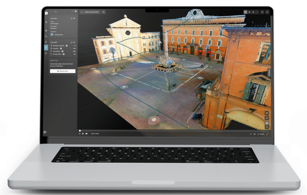
If you are new to reality capture, here’s a brief overview of what LiDAR and laser scanning technology are, how they work, and how they help create the point clouds used by Reality Cloud Studio, our cloud-based platform for collaboration, automated data registration, meshing, and data storage.
Let’s talk about LiDAR
LiDAR, or Light Detection and Ranging, was invented in 1960 and remained the province of super-high technology, reserved for specialized equipment and trained professionals. Now, it’s practically commonplace, with LiDAR sensors in our cars and smartphones, robot vacuums, and farming equipment.
LiDAR, in both mechanical and solid-state forms, powers the vast majority of Leica Geosystems’ hardware, from our popular BLK series to the Leica RTC360 and beyond. With a few lasers and the right secret sauce of software and firmware, you can capture the whole world in 3D.
But what is LiDAR, how does it work, and what does it produce?
LiDAR explained
LiDAR is straightforward – it is not unlike radar. It sends a laser pulse toward the object being measured, which will then bounce off the object and return to the LiDAR unit. This provides measurement data based on the distance it took for the laser to send and the distance the laser distance meter received. Each one of these laser measurements is a “point”. By repeating this super-fast process —millions of times a second—the system makes a detailed map of objects around it, called a point cloud.
This is the basic principle behind LiDAR devices in general. Still, there are two primary approaches to LiDAR measurement for 3D laser scanning: mechanical LiDAR, such as the dual-axis LiDAR in the Leica BLK360, Leica RTC360, the Leica BLK2GO, and solid-state LiDAR, such as the dual Time-of-Flight (ToF) sensors used in the Leica BLK2GO PULSE.
Here’s how they work.
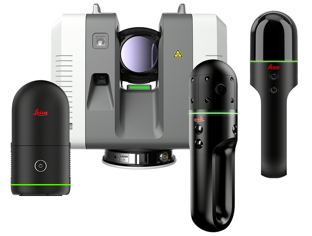
Mechanical LiDAR
Mechanical LiDAR systems use rotating mirrors or prisms to steer a laser beam across a wide field of view, allowing it to capture points in front of, above, and behind the laser scanner. These sensors are the gold standard for high-resolution 3D reality capture with a healthy range dictated by the strength of the laser and its concentrated beam.
Solid-state LiDAR
Solid-state LiDAR, on the other hand, has no moving parts. It’s small, durable, and compact, so it’s the type of LiDAR appearing in consumer products such as high-end smartphones.
The BLK2GO PULSE, for instance, uses a solid-state LiDAR system with two Time-of-Flight sensors that measure the time the laser beam takes to return to the sensor in real-time. Because this system is solid-state, there is synchronicity between the measurements and data processing; this enables the BLK2GO PULSE to capture and deliver accurate point clouds to the user in real time, something mechanical LiDAR cannot do. The trade-off is a narrow Field-of-View with less precision than a mechanical unit.
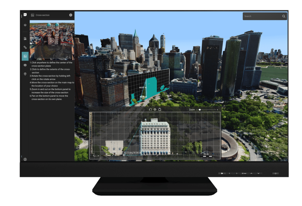
How does LiDAR create a point cloud?
We’ve discussed how LiDAR creates a point, but how does it work to create a point cloud?
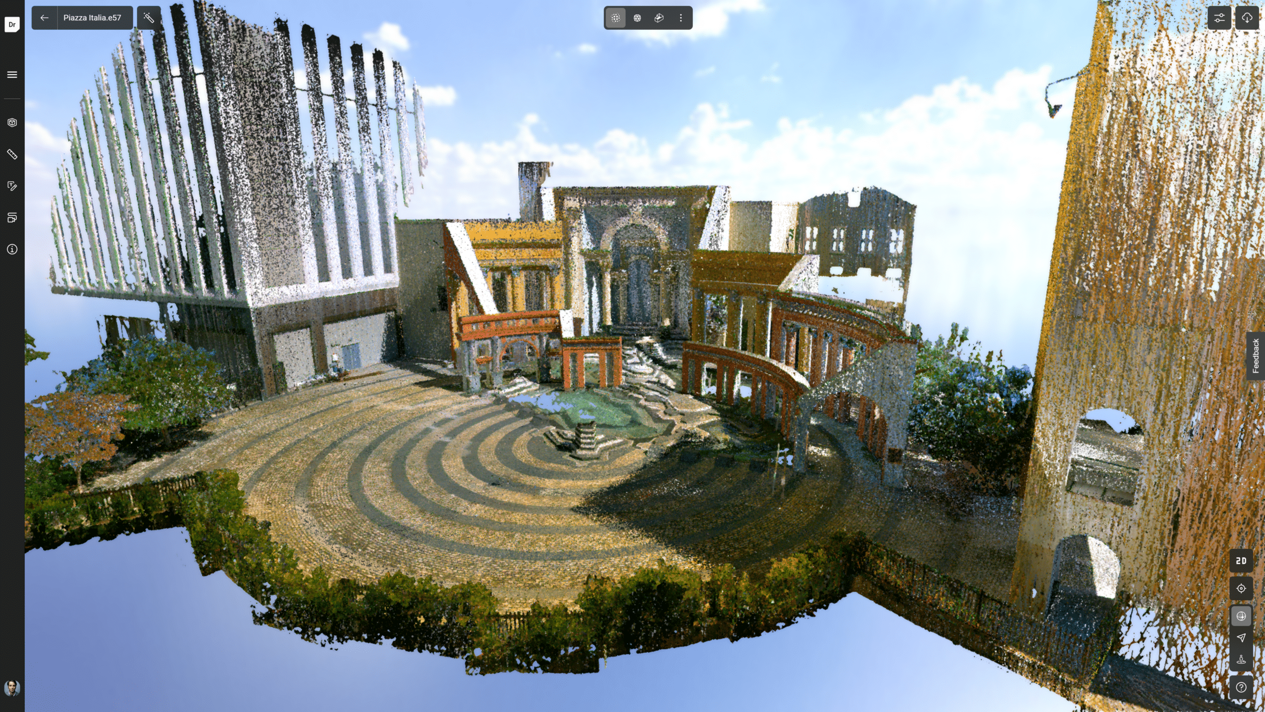
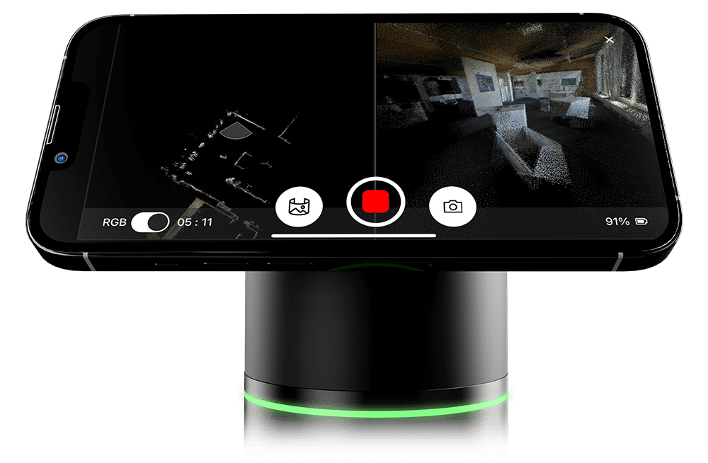
To capture a point cloud – a collection of millions of measurements in three dimensions representing a real-world structure, building, or object – LiDAR in a laser scanner works much faster than similar technology like a laser distance meter. In the BLK360, for example, it sends and receives 680,000 laser points per second as the scanner rotates 360 degrees to capture the entire space around it. It is still fundamentally a laser distance meter in some ways but supercharged through hardware and software. Because it works so fast and captures measurements in 360 degrees, it creates a point cloud rather than capturing only one or a few measurements at a time.
Those points – individual LiDAR measurements – come together within seconds as a digital representation of what the laser scanner captured. This can be an entire room, an entire building, or even an outdoor environment. It will capture everything in the laser scanner’s laser distance meter’s line of sight.