Hexagon GeoCloud

Hexagon GeoCloud Icon Lockup

Where geodata drives decisions

Centralise geodata so teams can share faster, collaborate better, and deliver results with less rework

Theatre dataset in Hexagon GeoCloud with GeoTags and area measurement.

OUTCOMES

What GeoCloud helps teams achieve

Accelerate delivery icon

Accelerate delivery

Reduce manual handling, simplifying project sharing, and keeping teams working from one connected workflow. Customers have reported up to 50% faster turnaround and major reductions in time-consuming manual work.

Checklist on tablet Icon

Reduce rework and repeated site visits

Give teams and stakeholders remote access to trusted project data so they can review conditions, validate analysis results, and make decisions with fewer delays and fewer return trips.

Cloud Icon

Lower infrastructure burden

Move away from overloaded local systems, expensive workstations, and fragmented storage environments with a cloud platform designed to scale.

Customers who use GeoCloud experience: 

Up to
50% faster
project turnaround

Up to
75% reduction
in total cost of ownership

Up to
10x increase
in data utilisation

Trusted by teams managing complex survey and reality capture workflows

From AEC and campus-scale Scan-to-BIM programmes to multi-site industrial projects, teams use GeoCloud to centralise data, simplify collaboration, and speed delivery.

When geodata is fragmented, delivery slows down

Speed up with one secure central source of truth for survey and reality capture data

Testimonial

The ability to share data easily and allow anyone to view it from anywhere has strengthened collaboration across regions and reduced the need for repeated site visits.

Thomas Coar | Associate Technical Director

Geomatics, Arcadis

Advancing how you work with geodata

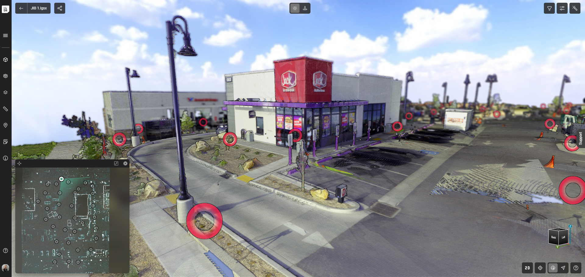
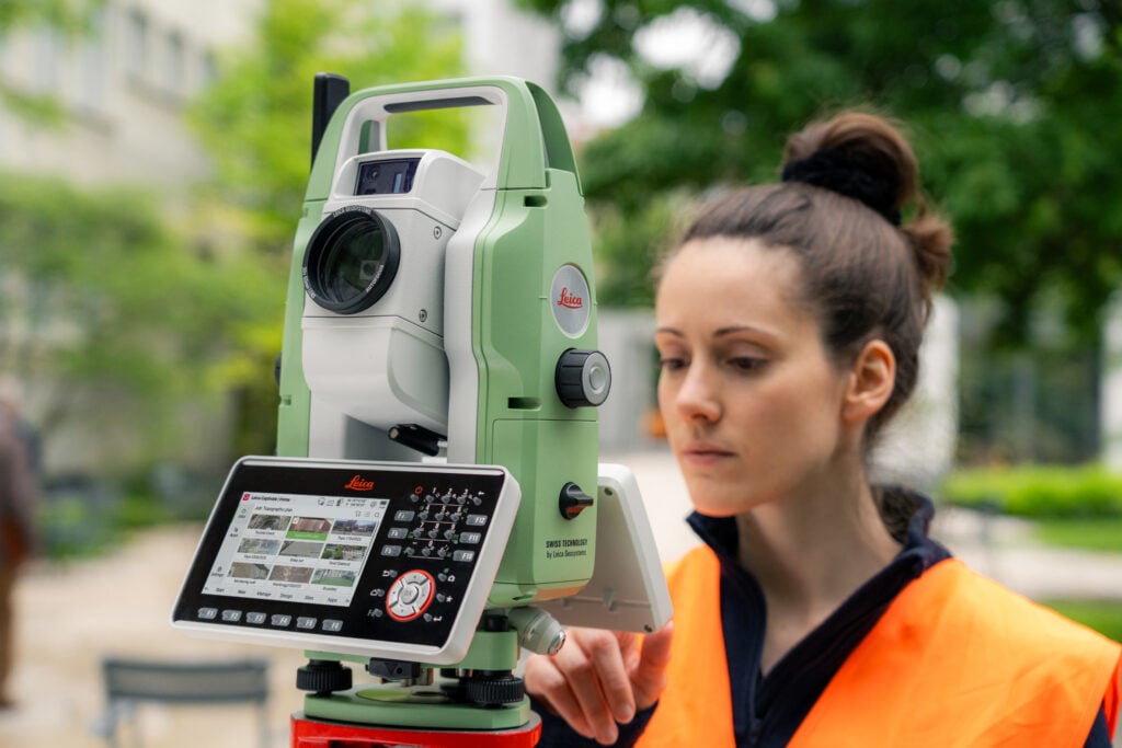
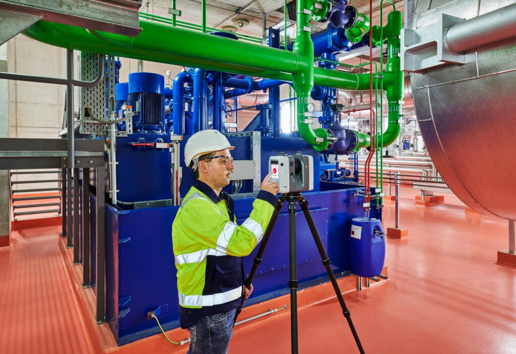
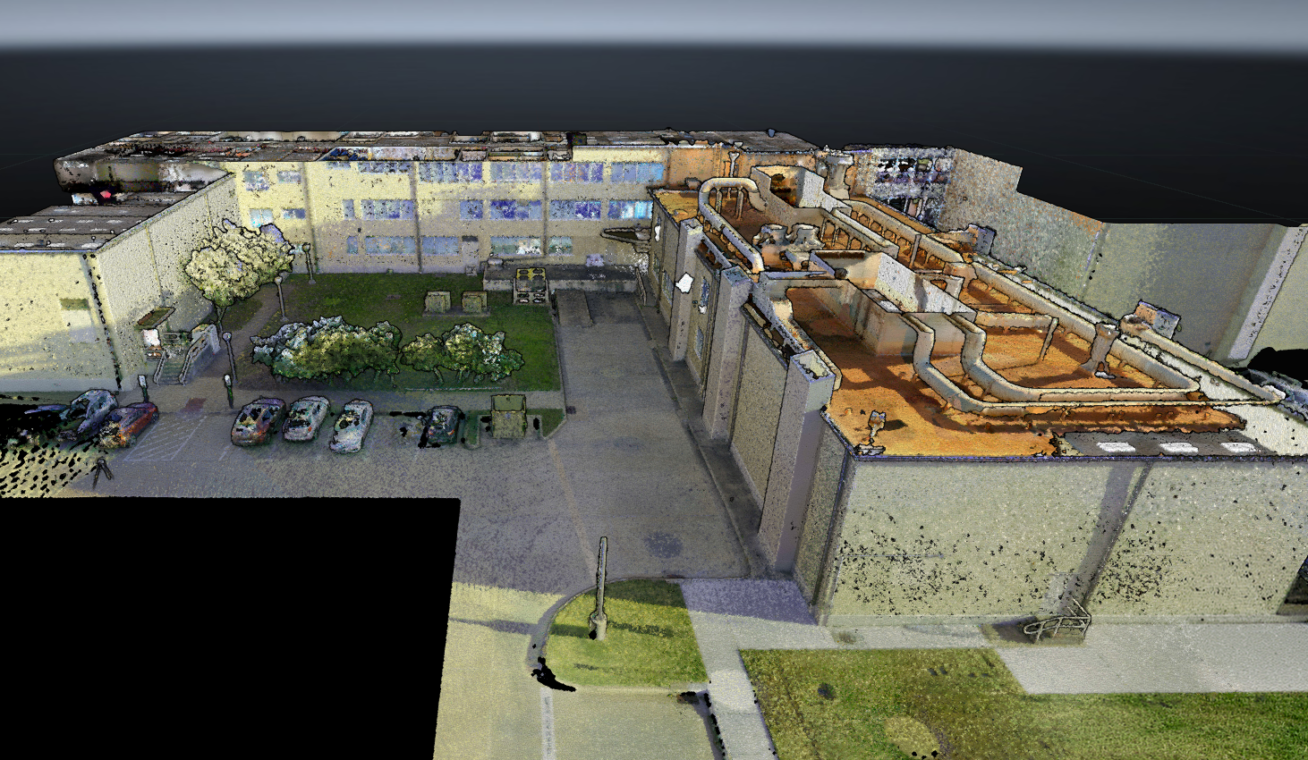
GeoCloud provides geodata visualisation and AI-powered analysis that bring together point clouds, survey points and linework, CAD data, and models to validate measurements, check geometry, and coordinate control and layout. In‑browser point cloud classification and meshing, measurement, GeoTags, and shared views help teams act on geodata in full spatial context, while desktop integrations empower scan-to-model and survey deliverables.

Centralise project data in one secure place 

Whether you’re a surveyor sharing project data and coordinate systems between the field, cloud, and office, or a project manager monitoring construction progress with daily point cloud scans, GeoCloud provides one unified, secure place to share all your project data.

Seamless connectivity to desktop applications, including streaming to Leica Cyclone 3DR and Leica CloudWorx for Scan‑to‑BIM and deviation analysis, or syncing with Leica Infinity for survey workflows.

Now, stakeholders can access survey and point cloud geodata anywhere, anytime from the web.

GeoCloud is data-agnostic, supporting survey and reality capture data from total stations, GNSS sensors, and laser scanners — including CAD, DBX, text-based point files, and formats such as E57 and LGSx. Data can be streamed or downloaded into software including Leica Infinity, Cyclone 3DR, Autodesk Revit, AutoCAD and more.

No more relying on hand-delivered hard drives or USB sticks. Your survey and reality capture data is shared and backed up securely in the cloud. Office teams can use their geodata right away. 

Automatically mesh, classify, and refine your geodata in the cloud with our AI-powered tools. Offload precious workstation time to our cloud servers for demanding processing tasks.

CAPTURE

in the field

MANAGE

in the office

Dataset in Hexagon GeoCloud with planar area measurement overlay showcasing the toolset within the platform

DELIVER

in the cloud

Dataset in Hexagon GeoCloud with GeoTags and a sharing modal for asset/deliverable team workflows

Testimonial

GeoCloud has completely changed how we manage our projects. What used to take hours of manual setup is now done in a fraction of the time, saving us up to 10-15 hours each project . It’s given our team the flexibility to focus on delivering results, not managing data.

Elizabeth McReynolds | Survey & High-Definition Scanning Manager

McNeil Engineering

Data in Reality Cloud Studio

See how GeoCloud fits your workflow

Bring your survey and reality capture data into one secure cloud workspace and give your teams a faster way to share, collaborate, and deliver. 

CASE STUDIES

Results customers actually see

McNeil Engineering

Eliminate up to 15 hours of manual work per project

McNeil Engineering eliminated repetitive manual processes, saving up to 10-15 hours per project.

Texas A&M

3x expansion of reality data use cases

GeoCloud enabled Texas A&M University to GeoTag equipment beyond building models and support more informed decisions across operations, leadership, and space planning.

Pell Frischmann

Cuts field and modeling time by 10% with GeoCloud

Cloud-based reality capture workflows help Pell Frischmann centralise scan data, streamline collaboration, and give clients and partners fast, secure access to complex project information.

Arcadis

~£120,000 saved by avoiding repeated site visit

Arcadis used virtual walkthroughs and shared cloud access to reduce repeat visits across 40 surveyed sites.

Built for secure, scalable collaboration 

GeoCloud helps teams work from accurate, trusted information with enterprise-grade security, centralised access, and a cloud service designed to scale without adding operational drag. 

SOC 2 Type 2 compliance badge

SOC 2 TYPE 2 cloud compliance

ISO Certified

ISO/IEC 27001-2022 certified

SSO Icon

SSO and controlled stakeholder access 

INDUSTRIES

Built for teams working across survey, construction, and asset-heavy environments 

Industrial and facilities teams

Support remote access, documentation, and decision-making for complex sites where safety, clarity, and accessibility matter.

Testimonial

Since implementing GeoCloud, we’ve seen an increase in efficiency through streamlined Revit workflows and faster geometry validation. Manual work has been reduced thanks to centralised imports that eliminated redundant modelling tasks

Brad Hollas | Facilities Analytics and Mapping Director

Texas A&M University

See how GeoCloud fits your workflow

Bring your survey and reality capture data into one secure cloud workspace and give your teams a faster way to share, collaborate, and deliver.