

What is a Point Cloud, and how does Reality Cloud Studio, powered by HxDR, use them?
When you use a LiDAR scanner to measure and capture a three-dimensional space, the output is called a “point cloud,” which is a collection of millions of 3D points reflected back into the sensor and processed via onboard software and hardware.
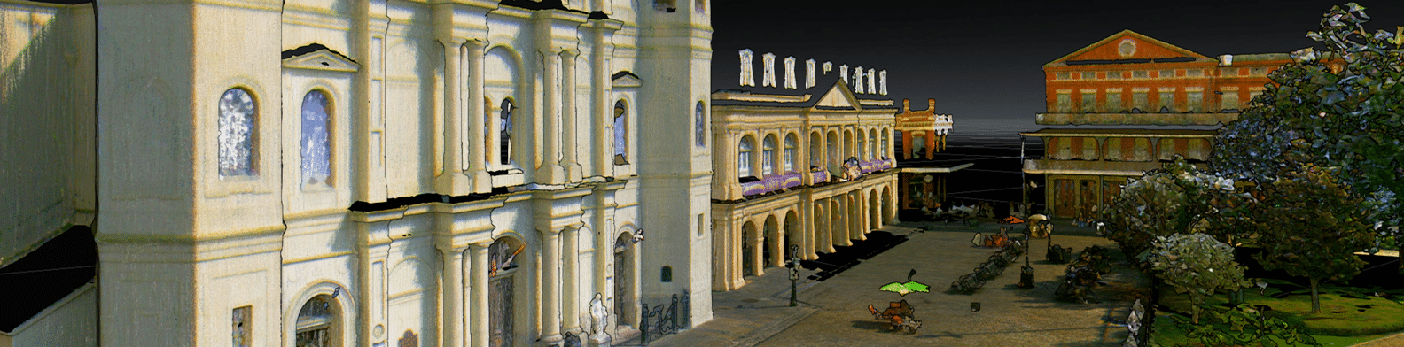
Think of a point cloud as the first step in creating a 3D model of the real world. It is a map made of points arranged in space that we have the potential to transform into 3D models. These could represent anything, from cityscapes or old historical sites, to buildings and manufacturing plants—and more.
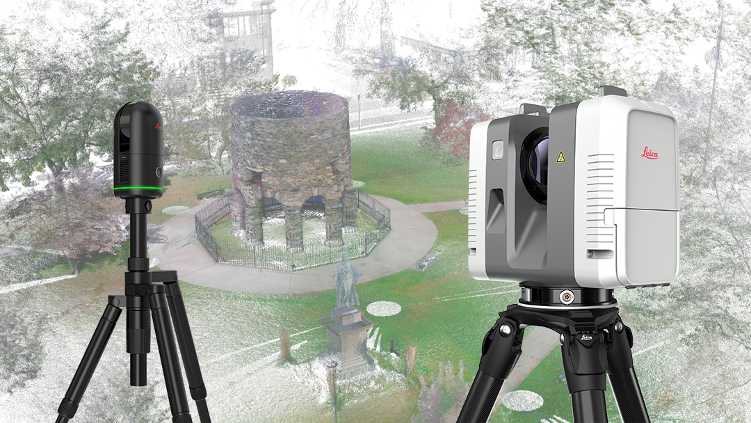
So how do we create a point cloud? With a Leica Geosystems laser scanner like a Leica RTC360 or Leica BLK360, you set the device up on a tripod where you want to measure and hit the start button. The laser scanner uses its LiDAR system to take the initial scan and its onboard Visual Inertial System (VIS) to track the scanner from setup to setup, aiding us in gathering all the data from individual scans into a complete, holistic “point cloud”.
Once we have our point cloud, the real fun begins. We can convert this massive collection of points into a 3D model. The process includes stitching overlapping scans together (registration) and turning point cloud data into polygons (meshing), which represent the surface of the objects we scanned.
How registration completes a point cloud
But let’s talk a little more about that registration step since you don’t have a “complete” point cloud until all your scans are registered together.
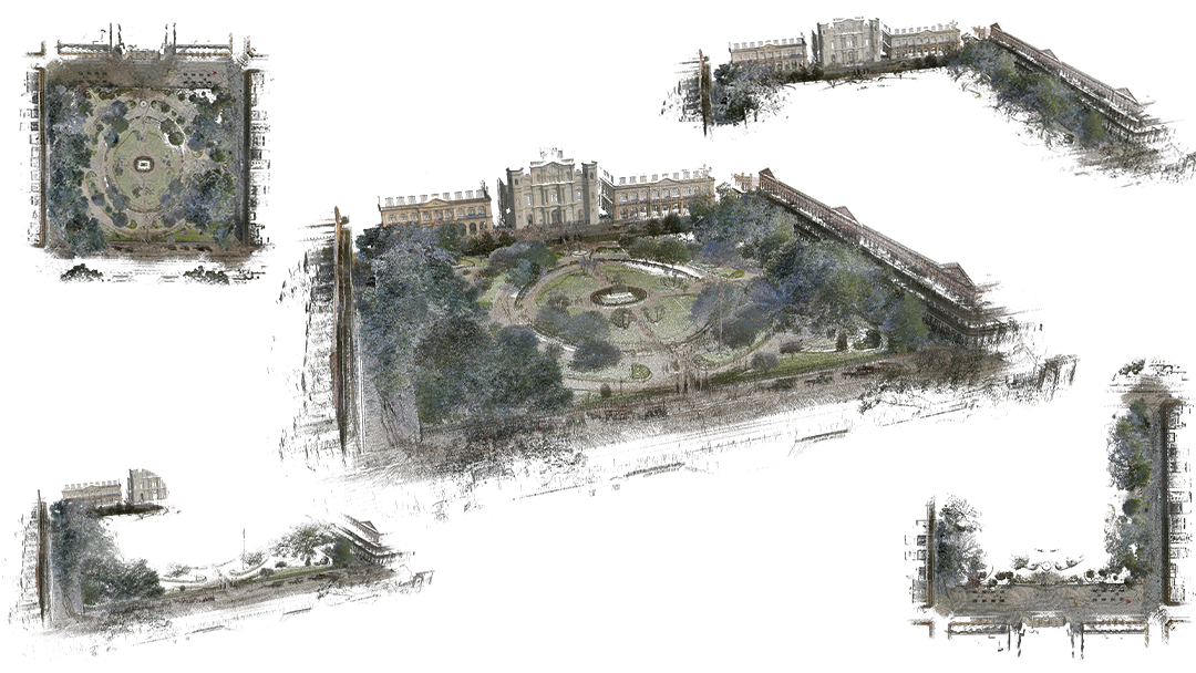
Each point cloud is created by combining individual scans, meaning that when an entire building or large space is scanned multiple times to capture the entire space, there will be multiple point clouds to register together. Once registered, the individual scans will be aligned as a dataset that represents your real-world space, object, building, or whatever else you’ve scanned.
Registration is an essential step in getting the most out of your data, from whatever scanner you choose to use. Without registration, you will just have individual point clouds that don’t represent everything you scanned.
That’s where Reality Cloud Studio comes in.
How do point clouds get processed, especially in Reality Cloud Studio?
With certain scanner data, Reality Cloud Studio can take the complex registration process and do it for you quickly, in the cloud, as soon as you upload your data. It takes a sometimes-challenging process and not only makes it simple, but it does it automatically, without any input from the user.
More importantly, Reality Cloud Studio also “meshes” point clouds automatically – which means that it fills in the tiny gaps between individual points in the point cloud to create a dataset that is uniform and complete and looks as much like the “real thing” as it can. From there, it’s a simple button click to export your mesh in the file type that most works for your workflow, or your clients’.
Reality Cloud Studio, combined with the ease of use of Leica Geosystems’ scanners and their ability to upload data directly from the field, offers a simple, fast, easy, and complete workflow, end-to-end, from capture to deliverable.
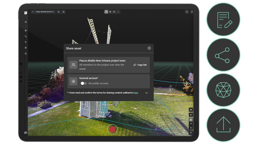
Once you’ve uploaded your point clouds and taken advantage of automated storage and processing, you can share that data with anyone. You can upload your scans to Reality Cloud Studio from the field and share them with your office team to get to work with the data without needing to wait and get a usable deliverable to clients in a rapid fashion. It takes reality capture processes – which include registration, not just scanning – and makes it simple for anyone to use.
Want to learn more? Stay tuned for the next article in this series, What is a Digital Twin?